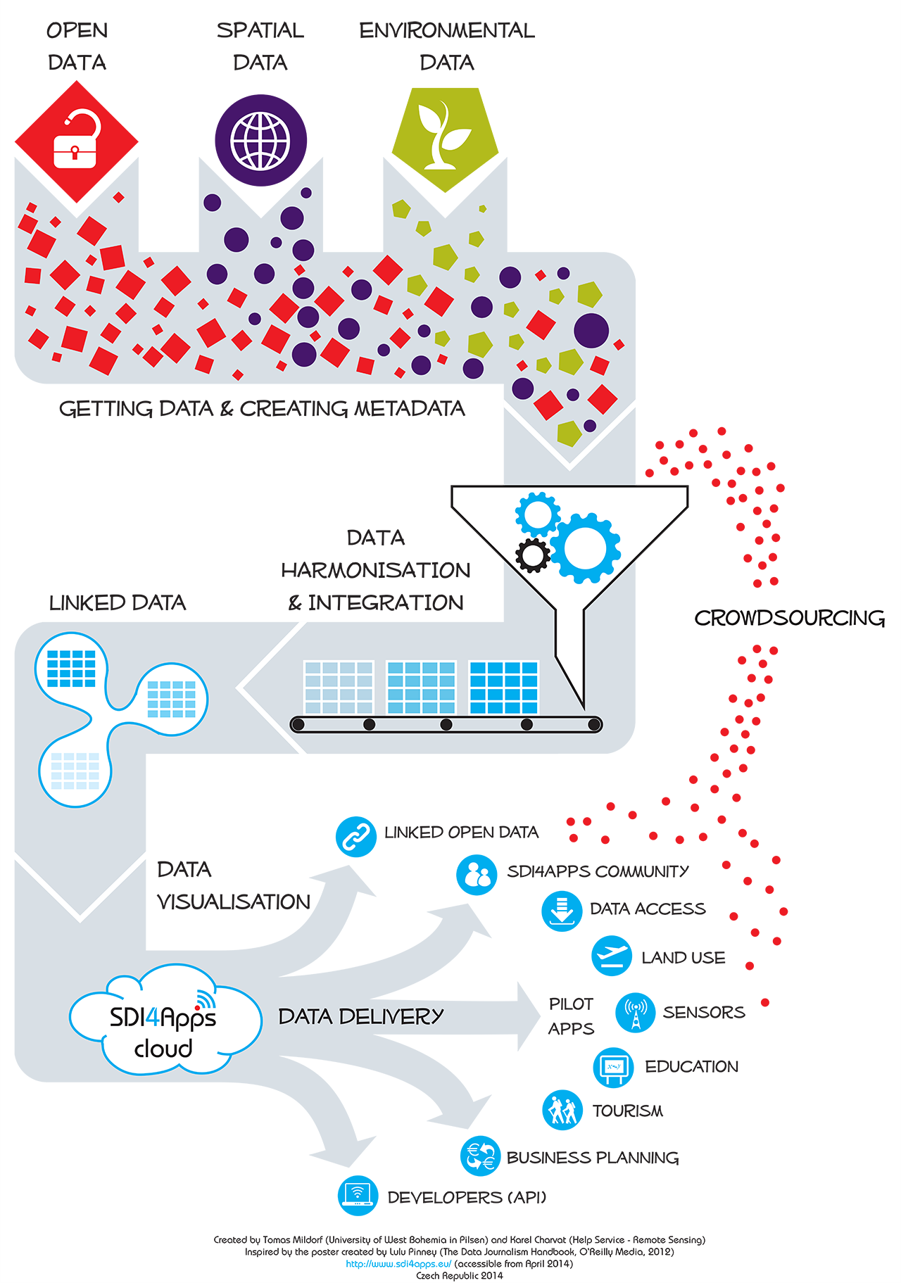
SDI4Apps is an EU-funded project managed by the University of West Bohemia from the Czech Republic. The project is being implemented with the concerted effort of 18 organizations across Europe. SDI4Apps seeks to build a cloud-based framework with open API for data integration focusing on the development of six pilot applications.
The project draws along the lines of INSPIRE, Copernicus and GEOSS and aspires to build a WIN-WIN strategy for building a successful business for hundreds of SMEs on the basis of European spatial data infrastructures.
Project homepage: www.sdi4apps.eu
Challenge
The European SDI (INSPIRE) is based on existing data of member states, focusing on harmonisation and interoperable exchange of spatial data and services. The main target of SDI4Apps is to bridge:
- the top-down managed world of INSPIRE, Copernicus and GEOSS built by SDI experts, and
- the bottom-up mobile world of voluntary initiatives and thousands of micro SMEs and individuals developing applications (apps)
SDI4Apps will secure that users profit from INSPIRE, and that INSPIRE profits from different voluntary initiatives, buy developing a WIN-WIN strategy for building a successful business for hundreds of European SMEs on the basis of INSPIRE, Copernicus and GEOSS.
The project has received funding from the European Union’s ICT Policy Support Programme as part of the Competitiveness and Innovation Framework Programme. Coordinator for the project is the University of West Bohemia in Pilsen, Czech Republic.
Scope of work
The main objectives of SDI4Apps are to:
- Integrate a new generation of spatial data infrastructure (SDI) based on user participation and social validation.
- Support easy discovery and accessibility of spatial data for everybody.
- Link spatial and non-spatial data using the Linked Open Data principles.
- Support multilingualism of spatial data.
- Build scalable cloud based infrastructure for support of SDI initiatives and location based services (LBS).
- Integrate in-situ measurements and Earth observation data.
- Design open application programming interface (API) supporting integration of spatial data and LBS into applications developed and deployed by non-GI developers.
- Integrate a demonstration set of pilot applications.
- Test new approaches for data sharing by users through pilot applications.
- Attract external developers (mainly from SMEs, students and researchers) to test the newly integrated platform.
- Organise contests for application developers supporting wider use of GI data.
- Build a sustainable business model for a cloud based SDI.
As technical partner in the consortium, NORPLAN subsidiary Asplan Viak Internet has been developing components for the system architecture, participated in code camps, provided training and prepared reports.
Project data
| Internal Project Number | 800988 |
|---|---|
| Project Title | Uptake of Open Geographic Information Through Innovative Services Based on Linked Data – SDI4Apps (CIP-ICT-PSP-2013-7) |
| Project Category | Research and development, System development, Environment, Smart cities, Innovation |
| Fields of Expertise | System architecture, system development, database technology, linked data, cloud computing. |
| Participating Offices | Asplan Viak Internet AS |
| Deliverables | Research and development. System components. Reports. |
| Project Duration | 2014-2017 |
| Project Location | European Union, European Economic Area |
| NORPLAN Contact Person | Mr (Stein) Runar Bergheim |
| Client | European Commission, ICT-PSP |
| Client Contact Person | Ms Saila Rinne, Project Officer, European Commission |
| Cooperating Partners | 18 partners from different European countries. See sdi4apps.eu for more information. |
| Project Value | USD 100 000 |

