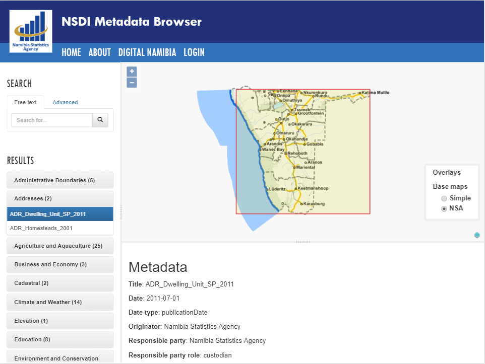
Namibia Spatial Data Infrastructure
Namibia Statistics Agency (NSA) has launched a national geographic portal to support the citizens in searching, evaluating and using data from different government institutions. Norplan has designed and implemented the technical infrastructure of the Namibian National Spatial Data Infrastructure.